
Weather data anchored in ground truth.
Access physical observations, site forecasts and forecast verification through one commercial interface. Use existing Network coverage, your own WeatherXM stations, or dedicated deployments where the data is missing.
38.25°N, 21.74°E · Elev 112m
Trained on local ground series
Site, variable & horizon score
Real-time and historical physical measurements with station context.
Forecasts placed next to the locations and observations they need to represent.
FACT measures forecast error against observed outcomes at the same site and time.
Measurements from the places where decisions happen.
WeatherXM observations come from physical stations deployed at homes, farms, industrial sites, ports, energy assets and other real-world locations. They make local conditions measurable where reference networks are too sparse for the decision at hand.
Use current and historical observations for monitoring, analytics, model training, forecast validation and applications that need evidence closer to the ground.
WeatherXM AG provides the commercial data and service relationship. The independent WeatherXM Network Association manages Network participation, rewards, governance and Network Dataset licensing. Commercial customers work with WeatherXM AG for delivery, APIs, analytics, support and project-specific requirements.
Global model misses nocturnal cold pool
Put the forecast next to the ground truth.
A forecast becomes more useful when it can be examined against the weather measured at the same location. WeatherXM brings site forecasts and observations into the same workflow so operational users and data teams can see both the prediction and the evidence around it.
Don't guess which forecast is best. Measure it.
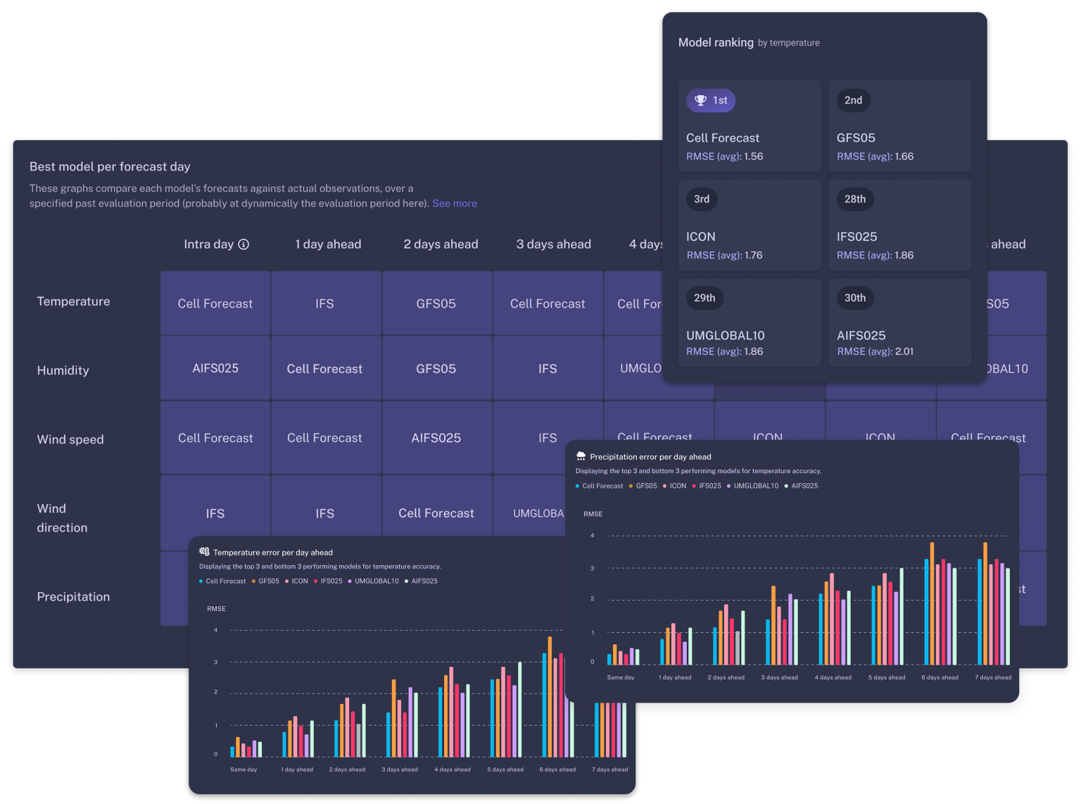
FACT archives a forecast before the event, then compares it with the WeatherXM observations collected afterward at the same place and time. That turns forecast quality into something measurable by site, variable and lead time.
WeatherXM tracked drop within 12 min.
| Rank & Model | MAE (Temp) | RMSE | Directional Bias | Audit Status |
|---|---|---|---|---|
| 1 WeatherXM Calibrated | 0.58°C | 0.72°C | +0.04°C (Unbiased) | Ground Verified ✓ |
| 2 ECMWF IFS (0.25°) | 1.82°C | 2.15°C | +1.35°C (Warm bias) | Standard NWP |
| 3 GFS NOAA (0.25°) | 2.38°C | 2.89°C | +1.82°C (Warm bias) | Standard NWP |
| 4 Customer Model (BYOF) | 1.95°C | 2.31°C | -0.42°C (Cold bias) | Custom Ingest |
Bring your own forecast.
WeatherXM can evaluate customer-supplied or third-party forecasts against local observations. FACT remains useful even when WeatherXM is not the source of the forecast itself.
Discuss Forecast Verification →Use the observation layer at the scale your application needs.
Start with the stations you already operate, add existing Network coverage, license a regional dataset, or deploy new density where the current observation layer is not enough.
Monitor deployed sites
Use observations, forecasts and verification around WeatherXM hardware at locations you operate.
Add existing ground truth
Use existing WeatherXM Network observations in products, analytics, model workflows and operational systems.
License data at scale
Access historical or ongoing observations across custom geographic areas and larger data pipelines.
Deploy where data is missing
Add station density, connectivity and custom delivery around the exact locations your application needs.
Explore in the Portal. Integrate through the API.
WeatherXM Pro is the interactive interface for people working with sites, observations, forecasts and verification. The API exposes the same underlying weather intelligence to software and operational workflows.
WeatherXM Pro
Explore stations and sites, inspect observations, compare forecasts and analyse forecast performance in one interface.
 Open WeatherXM Pro ↗
 WeatherXM API
Bring observations, forecasts and analytics directly into software, operational workflows and research pipelines.
Machine-native access when you need it.
The WeatherXM API is the primary integration surface. MCP and machine-oriented interfaces extend it for agent and automated workflows where those patterns are useful.
Tell us where you need weather evidence.
We can start from existing coverage, identify the gaps, and combine observations, forecasts and verification around the locations and decisions that matter to your application.